01-10: CBACBBBCCB
11-20: ABBDACCDBA
21-30: BBDCCCBADA
31-40: BABDABDBDA
41-50: CACACCACBD
COMPLETED!!!
WAEC Geography Essay 2025
Number 1
(1a)
(i)Rapid population growth: Developing countries often experience high rates of urbanization as people migrate from rural areas to cities in search of opportunities.
(ii)Informal settlements:
Due to rapid urbanization and lack of affordable housing, many urban areas in developing countries have a significant presence of informal settlements or slums.
(iii)Inadequate infrastructure: Urban areas in developing countries often struggle with inadequate infrastructure, including limited access to clean water, sanitation, electricity, and transportation.
(iv)High levels of unemployment and
poverty: Despite the opportunities that cities offer, many urban residents in developing countries face high levels of unemployment and poverty.
(v)Social and economic
inequalities: Urban areas in developing countries often exhibit significant social and economic inequalities, with disparities in access to resources, opportunities, and services.
(1b)
(i)Food supply: Urban areas depend on rural settlements for their food supply, as rural areas are often the primary producers of agricultural products.
(ii)Labor force: Rural areas often provide a labor force for urban industries and services, as people migrate from rural areas to cities in search of employment.
(iii)Natural resources: Urban areas depend on rural areas for natural resources, such as water, timber, and minerals.
(iv)Recreation and tourism: Rural areas often provide recreational and tourist opportunities for urban residents, offering a break from the hustle and bustle of city life.
Cultural and social
(v)connections: Urban areas often maintain cultural and social connections with surrounding rural areas, as many urban residents have family and cultural ties to rural communitie
==================
Number 2
(2a)
The balance of trade is the difference between a country’s total value of exports and its total value of imports over a specific period.
(2b)
(i)Demand for raw materials: Developed countries often require raw materials and agricultural products that are abundant in Tropical Africa.
(ii)Demand for manufactured goods: Tropical African countries often need manufactured goods and technologies that are produced in developed countries.
(iii)Investment: Foreign direct investment from developed countries can help boost production and trade in Tropical Africa.
(iv)Trade agreements: Trade agreements between Tropical African countries and developed countries can reduce trade barriers and promote trade.
(v)Transportation: Improvements in transportation infrastructure, such as ports and roads, can facilitate trade.
(2c)
(i)Increased economic growth: Trade can increase economic growth by allowing countries to specialize in the production of goods and services in which they have a comparative advantage.
(ii)Access to new markets: International trade provides access to new markets for Tropical African products, which can lead to increased sales and revenue.
(iii)Access to technology: International trade can provide access to new technologies and know-how, which can help to improve productivity and efficiency.
(iv)Job creation: International trade can create new jobs in export-oriented industries.
==================
Number 3
(3a)
Pipeline transportation is the method of transporting liquids and gases through a system of pipes from one location to another.
(3b)
(i) Crude oil
(ii) Natural gas
(3ci)
(i)Cost-Effective: Pipelines are a cost-effective way to transport large volumes of liquids and gases over long distances, reducing transportation costs compared to other methods.
(ii)Continuous Supply: Pipelines provide a continuous and reliable supply of resources, ensuring a steady flow of materials like oil and gas.
(iii)Environmentally Friendly: Compared to other modes like rail and oil ships, pipelines have a reduced environmental impact, especially when buried underground.
(iv)Reduced Traffic Congestion: Pipelines can help alleviate traffic congestion by reducing the need for trucks and other vehicles to transport goods.
(3cii)
(i)Vandalism and Theft: Pipelines are susceptible to vandalism and theft, which can lead to leaks, environmental damage, and economic losses.
(ii)High Initial Costs: Building pipelines requires significant upfront investment, which can be a barrier to development, especially in countries with limited resources.
(iii)Land Acquisition Challenges: Constructing pipelines often involves acquiring land, which can be difficult and lead to conflicts with local communities.
(iv)Maintenance and Repair: Pipelines require regular maintenance and repair, and failures can lead to disruptions in supply and environmental contamination.
==================
Number 4
(4a)
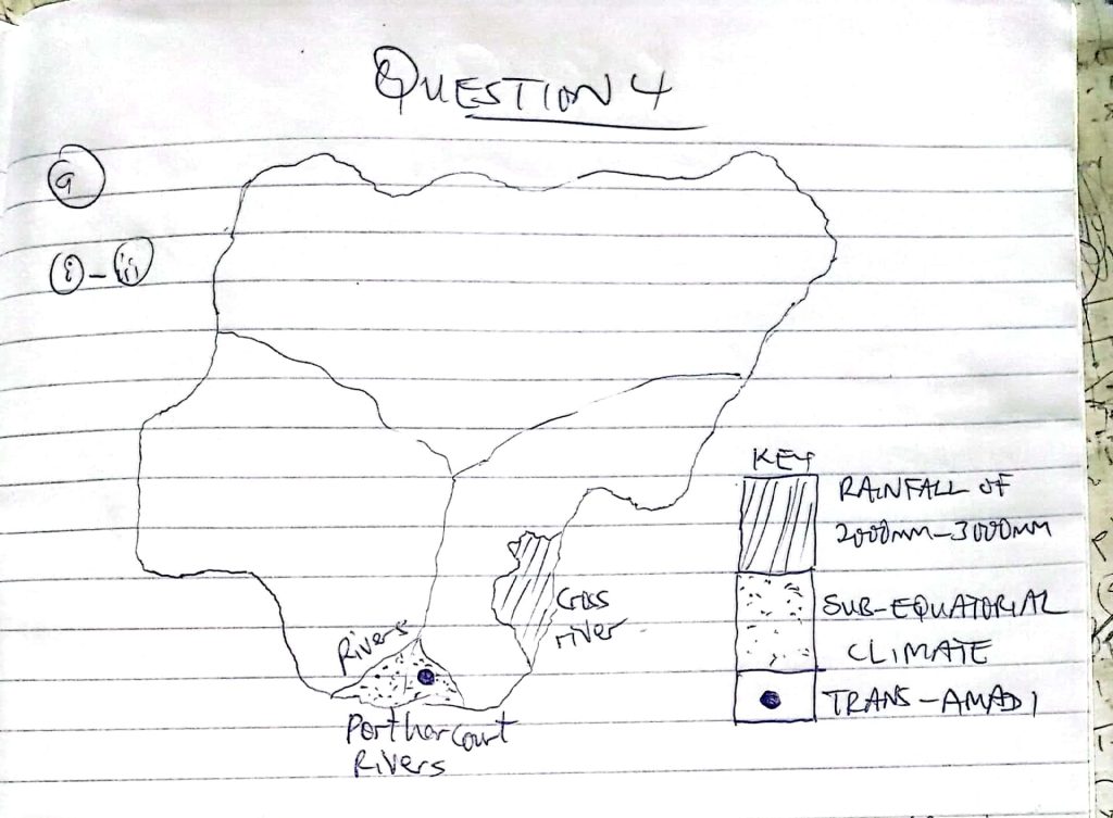
(4b)
(i)Latitude: Areas closer to the equator generally receive more rainfall than those further away.
(ii)Prevailing Winds: The direction and moisture content of winds influence rainfall patterns.
(iii)Altitude: Higher elevations tend to receive more rainfall than low-lying areas.
(iv)Distance from the Coast: Coastal regions receive more rainfall compared to inland areas.
(4c)
(i)High Rainfall: Sub-equatorial regions experience high annual rainfall, often exceeding 1500 mm.
(ii)High Temperatures: Temperatures are consistently high throughout the year.
(iii)Short Dry Season: The dry season is relatively short and less intense compared to other parts of Nigeria
==================
Number 5
(5a)
(i)Suitable Climate: Nigeria has a tropical climate with high rainfall and temperatures, ideal for cocoa growth.
(ii)Fertile Soil: The country has areas with well-drained, fertile soil that supports cocoa cultivation.
(iii)Traditional Farming Knowledge: Many farmers possess traditional knowledge of cocoa farming practices.
(iv) Government Support: Government initiatives, such as subsidies and training programs, encourage cocoa farming.
(v)Market Demand: Both local and international demand for cocoa beans provides an incentive for farmers to cultivate cocoa.
(5b)
(i)Pest and Disease Control: Implementing effective pest and disease management strategies can reduce crop losses.
(ii)Improved Farming Techniques: Training farmers on modern farming techniques, such as pruning and fertilization, can increase yields.
(iii)Access to Credit:
Providing farmers with access to loans and financial assistance can help them invest in their farms.
(iv)Infrastructure Development: Improving transportation infrastructure can facilitate the movement of cocoa beans to markets.
(v)Research and Development: Investing in research to develop high-yielding and disease-resistant cocoa varieties can boost production.
==================
Number 6

COMPLETED!!!
WAEC Geography 3 (Practical & Physical Geography) 2025
Number 1
(1a)
Coming….
(1b)
Coming….
(1c)
(i)Transport Junction: KARLAHI is located at the intersection of major and minor roads, making it a central hub for transportation and communication within the mapped area.
(ii)Largest Settlement: It is visibly the largest settlement on the map, indicating a higher population density and more developed infrastructure compared to other settlements.
(iii)Presence of Institutions: KARLAHI hosts key facilities such as a school, a market, and possibly other services (as shown by symbols), which attract people from surrounding areas for education, trade, and services.
(1d)
(i)Farming and Agriculture: The map shows extensive farmland and scattered rural settlements, indicating that crop farming and possibly livestock rearing are primary occupations.
(ii)Trading/Commerce: The presence of markets (indicated by market symbols) shows that trading is a significant economic activity, with goods likely being exchanged within and outside the region.
(iii)Education: The presence of schools (school symbol) suggests that teaching and educational services contribute to the local economy, providing employment and attracting students from nearby villages.
==================
Number 2
Answers Loading…
==================
Number 3
(3a)
The lithosphere is the outermost solid layer of the Earth, comprising the crust and the uppermost part of the mantle.
(3b)
(i)Rigid and brittle: The lithosphere is a rigid and brittle layer that can break and deform under stress, resulting in earthquakes and volcanic activity.
(ii)Composed of rocks: The lithosphere is made up of a variety of rocks, including granite, basalt, and sedimentary rocks.
(iii)Dynamic and in motion:The lithosphere is broken into several large plates that are in constant motion, resulting in plate tectonics and geological activity.
(3c)
(i)Source of minerals and resources: The lithosphere is a source of many valuable minerals and resources, including metals, fossil fuels, and construction materials.
(ii)Supports plant growth: The lithosphere provides the soil and nutrients necessary for plant growth, which is essential for agriculture and ecosystems.
(iii)Foundation for infrastructure: The lithosphere provides a solid foundation for buildings, roads, and other infrastructure, allowing humans to build and develop communities.
(iv)Habitat for organisms: The lithosphere provides a habitat for a wide range of organisms, from microorganisms in soil to plants and animals that live on and beneath the Earth’s surface.
(v)Stores Earth’s history: The lithosphere contains a record of the Earth’s history, including fossil evidence of past life forms and geological events.
==================
Number 4
(4a)
An artesian well is a type of well that taps into a confined aquifer, where water is under pressure and flows naturally to the surface without the need for pumping.
(4b)
(i)Presence of a Permeable Rock Layer (Aquifer): There must be a layer of porous and permeable rock (such as sandstone or limestone) that can store and transmit water.
(ii)Impermeable Layers Above and Below the Aquifer: The permeable aquifer must be sandwiched between two impermeable rock layers (such as clay or shale) to prevent water from escaping vertically.
(iii)Inclined Aquifer Structure: The aquifer must be tilted or inclined so that one end is exposed at a higher elevation to a recharge area, allowing water to enter and build up pressure.
(iv)Recharge Area at a Higher Elevation: The exposed end of the aquifer must be at a region of higher ground, where rainwater or surface water can infiltrate and recharge the aquifer, increasing the hydraulic pressure necessary for water to rise to the surface when a well is drilled.
(4c)
(i)Reliable water source: Artesian wells can provide a reliable source of water, especially in areas where surface water is scarce or unreliable.
(ii)Low maintenance: Since the water flows naturally to the surface, artesian wells require minimal maintenance and no pumping, making them a cost-effective option.
==================
Number 5
Answers Loading…
==================
Number 6
==================
Number 7
(7a)
(i)Deflation
(ii)Abrasion
(iii)Attrition
(7bi)
(i)Both Are Wind-Eroded Landforms: Zeugen and yardangs are formed primarily by the action of wind (aeolian erosion) in arid or semi-arid environments.
(ii)Elongated Shapes: Both landforms are elongated, ridge-like features that are typically aligned in the direction of prevailing winds.
(iii)Composed of Alternating Hard and Soft Rock Layers: Each landform develops where there are layers of resistant (hard) and less resistant (soft) rocks, allowing wind abrasion and deflation to sculpt their shapes.
(7bii)
(i)Formation Process:
-Zeugen: Formed mainly by wind abrasion along horizontal layers of alternating hard and soft rocks undercutting the soft layers beneath a hard cap.
-Yardang: Formed by both wind abrasion and deflation, with the wind cutting through vertical or gently sloping beds, creating streamlined ridges and troughs.
(ii)Rock Structure:
-Zeugen: Usually develop in areas with horizontal bedding planes of hard and soft rocks.
-Yardang: Often develop in regions with vertical or steeply inclined beds of rock.
(iii)Appearance and Size:
-Zeugen:Generally have a flat-topped appearance due to the hard cap rock, and are often larger and less streamlined.
-Yardang: Tend to be more streamlined, narrow, and pointed at the windward end, and are usually smaller than zeugen.
==================
Number 8
(8a)
The natural environment refers to the physical surroundings and ecosystem of the Earth, including the atmosphere, hydrosphere, lithosphere, and biosphere, that exist independently of human activity.
(8b)
(i)Deforestation: Large areas of forests are cleared for agriculture, urban development, and logging. This leads to loss of biodiversity, disruption of ecosystems, and contributes to climate change through increased carbon dioxide in the atmosphere.
(ii)Pollution: Human activities introduce harmful substances into the environment, such as industrial waste, plastic, pesticides, and oil spills. Pollution contaminates air, water, and soil, leading to health problems for humans and wildlife.
(iii)Overexploitation of Natural Resources: Excessive extraction of resources like minerals, fossil fuels, fish, and timber depletes these resources, disrupts habitats, and can lead to the extinction of species.
(iv)Urbanization and Land Degradation: The expansion of cities and infrastructure converts natural land into built environments. This causes habitat loss, soil erosion, and increased runoff, which can lead to flooding and reduced soil fertility.
(8c)
(i)Sustainable practices: Adopting sustainable practices such as renewable energy, sustainable agriculture, and reducing waste and pollution.
(ii)Conservation and protection: Establishing protected areas, conserving biodiversity, and protecting ecosystems and natural habitats.